Scientists follow a ‘yellow brick road’ in a never-before-seen spot of the Pacific ocean

The path to the Emerald City might travel along the ocean’s bottom. The crew (researerchers) of the Exploration Vessel Nautilus caught sight of a strange-looking formation while studying an area called Liliʻuokalani Ridge in the Papahānaumokuakea Marine National Monument in the Pacific Ocean.

“The yellow brick road?” a scientist mused in an interview of the discovery in April 2022. Others remarked that the rocks were reminiscent of a very different fictional world: “It’s the road to Atlantis,” one researcher said.

The golden boulders, separated by perfect 90-degree angles, form a small strip that appears to have been chiseled and organized by human hands. The seemingly paved street, however, was merely the natural product of old volcanic activity hundreds of feet below the water’s surface, according to the researchers.

“At the summit of Nootka Seamount, the team spotted a ‘dried lake bed’ formation, now IDed as a fractured flow of hyaloclastite rock (a volcanic rock formed in high-energy eruptions where many rock fragments settle to the seabed),” the researchers said.

“The remarkably brick-like divisions between the rocks are likely the coincidental result of heating and cooling stresses from multiple volcanic eruptions over millions of years”, the team added.

While piloting a remotely operated vehicle (ROV) around the Papahnaumokuakea Marine National Monument, a protected conservation area encompassing approximately 582,578 square miles (1,508,870 square kilometers) of the Pacific Ocean northwest of Hawaii, the researchers took a detour down this eerie undersea road.

The expedition is part of the Ocean Exploration Trust’s Nautilus Exploration Program, and its goal is to examine the ancient seamounts at Liliuokalani Ridge, which is located on the monument’s western boundary.

One of the team’s primary objectives is to gather geological samples from the area’s seamounts, which are underwater mountains generated by volcanic activity, in order to better understand their ages and origins. The crew will also gather microbial samples to see what types of strange creatures have managed to live near the Pacific’s deep, underwater volcanoes.

“Our exploration of this never-before-surveyed area is helping researchers take a deeper look at life on and within the rocky slopes of these deep, ancient seamounts,” the researchers added. Previous expeditions aboard the Nautilus research vessel have unearthed a plethora of eerie aquatic anomalies.

During a trip to the Papahnaumokuakea Marine National Monument in 2018, researchers were taken aback by a wiggling, googly-eyed creature that appeared to change shape in front of the camera.

The species was eventually recognized as a gulper eel (Eurypharynx pelecanoides), a gigantic-mouthed fish that can unhinge its enormous jaw to consume anything larger than itself.

The researchers in command of the ROV during that voyage also made a cultural allusion in response to the unexpected scene in front of them. “Looks like a Muppet,” one researcher said.

Source: https://mysteriesrunsolved.com/2022/06/yel...

Underwater ruins of 3,000-year-old castle discovered in Turkey

Archaeologists in Turkey's eastern Van province discovered the ruins of a 3,000-year-old Urartu castle during underwater excavations in lake Van.

The excavation led by Van Yüzüncü Yıl University and Governorship of Turkey's eastern Bitlis Province revealed that the underwater ruins are supposedly from the Iron Age Urartu civilization, also known as the Kingdom of Van, thought to date back to the eighth to seventh centuries B.C.

"There was a rumor that there might be something under the water but most archaeologists and museum officials told us that we won't find anything," the head of the diving team Tahsin Ceylan said, adding that they proceeded with the research and discovered the ancient castle.

The current water level of Van Lake, which has a history of 6,000 years, is reportedly several hundred meters higher than it was during the Urartu civilization.

Civilizations living around the lake set up large villages and settlements while the water level of the lake was low, but they had to leave the area after it increased again, Ceylan said.

The research couldn't determine how much of the walls of the castle are buried, but about three to four meters are seen above the water.

"We will have to hold underwater excavations to find out about that" he added.

The underwater ruins are expected to attract the interest of thousands of tourists due to its unique historical worth.

Lake Van is the largest lake in Turkey and the second largest in the Middle East. It's also the biggest sodium water lake in the world. The lake lies on the high grounds of Eastern Anatolian region near the border with Iran. It was formed by a crater caused by a volcanic explosion of Mount Nemrut near the province of Van.

Source: https://www.dailysabah.com/history/2017/11...

This Canadian Lake Is Filled by a Submerged Ghost Village

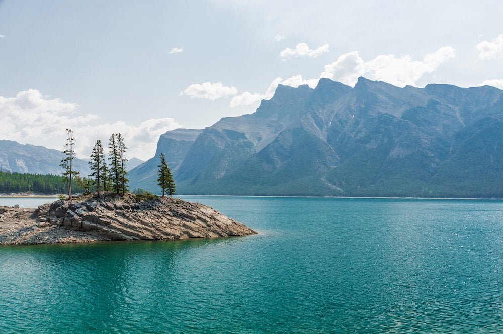
Lake Minnewanka in Alberta appears to be typical of other huge bodies of water in Canada from the outside. The 13-mile-long lake, which is surrounded by clumps of evergreen trees and located close to the eastern side of what is now known as Banff National Park, has long been a popular destination within the park, luring visitors to its brisk, clear waters on kayaks, hikes, and bicycles. But many people are unaware that the lake is a relatively recent addition to the surrounding terrain and that, prior to its flooding, the area was home to a thriving lakeside resort town that is now only accessible by scuba equipment.

The summer resort town of Minnewanka Landing, which is situated at the foot of the Canadian Rockies, has long been luring residents of adjacent Calgary. This is especially true since the Beach House, a log-built hotel, was finished in 1886. Over time, the town expanded to encompass three streets, four avenues, dozens of cottages, numerous hotels, and sailing companies that offered boat tours around the (much smaller) original lake.

The area's terrain wouldn't begin to change until 1912, when Minnewanka Landing was largely flooded as a result of the construction of a new dam as part of the establishment of a hydroelectric plant operation by Calgary Power Co. downriver. The town would eventually meet its end in 1941 with the construction of a new dam, which raised the reservoir's waters by 98 feet, swallowing everything in its wake. Nevertheless, the town continued to prosper over the following 20 years (42 lots were erected to provide room for additional cabin sites).

According to William Perry, an archeologist with Parks Canada, "it was during the Second World War, and everyone was hungry for power." At that time, Calgary and the surrounding area were rapidly expanding and needed more electricity; therefore, Lake Minnewanka was viewed as a simple solution.

Unless they are scuba divers, many people today will never have the opportunity to discover the secret that the reservoir contains. Several of the ancient resort town's buildings, including house and hotel foundations, wharves, an oven, a chimney, a cellar, bridge pilings, and walkways, are still standing today because of Lake Minnewanka's glacier-fed, ice-cold waters. (You may see a complete list of websites here.) Even the footings from the federal government's first dam in the town, constructed in 1895, and the footings from the dam completed in 1912 are still clearly visible.

An ancient native encampment in the area is another noteworthy location. Archaeologists have recently discovered spear points, arrowheads, atlatls, stone tools, and other artifacts used by the native cultures that originally inhabited the area.

“What is particularly interesting about that for me is looking at the whole area as a cultural landscape,” Perry says. “The area's 13,000 years of continuous use absolutely fascinates me.”

And Perry isn’t alone. He estimates that approximately 8,000 divers descend into the lake each year to explore its hidden past.

“Because of the cold, clear water, wood actually survives quite well down there,” he says. “That’s why it has become such a popular diving place for local scuba diving clubs. There's just so much left to see."

Discovering the Heracleion's Lost City: Meeting Myth Beneath the Waves

Almost 1,200 years ago, the Mediterranean Sea engulfed the city of Heracleion off the coast of Egypt. Before it sank more than a thousand years ago, it was one of the most significant commercial hubs in the Mediterranean. Like the way the modern world sees the city of Atlantis, Heracleion was long thought to be a myth. But after doing significant underwater investigation in the present-day Aboukir Bay, underwater archaeologist Franck Goddio eventually located the submerged city in 2000.

Heracleion had been reduced to only a few inscriptions and sentences in old texts by authors like Strabo and Diodorus before this recent discovery. When the mythical hero Heracles (also known as Herakles) first stepped foot in Egypt, a massive temple was built there, according to the Greek historian Herodotus (5th century BC). He also asserted that Paris and Helen of Troy paid the place a visit prior to the legendary Trojan War. The Greek explorer Strabo observed that the city of Heracleion was situated east of Canopus at the mouth of the River Nile, four centuries after Herodotus had traveled to Egypt.

The Seeker of Lost Cities Discovers Heracleion by Franck Goddio

A "pioneer of modern maritime archaeology," Franck Goddio is a well-known underwater archaeologist. In order to discover and study underwater archaeological sites, Goddio established the European Institute for Underwater Archaeology (IEASM) in 1987. On underwater archaeological sites, IEASM is renowned for having established a methodical methodology using geophysical prospecting methods. The crew can find anomalies on the sea floor by moving over the region in parallel straight lines at regular intervals. These anomalies can then be investigated by divers or robots.

In order to locate Canopus, Thonis, and Heracleion—all of which were thought to have been submerged beneath the Mediterranean Sea—IEASM started mapping the area around the port of Alexandria in 1992. In 1996, they expanded their research to include Aboukir Bay at the request of the Egyptian government. They were able to comprehend the topography and conditions that led to the area's gradual submersion thanks to this investigation. The group identified the areas of primary interest using data from historical documents. Aboukir Bay's survey covered a field of study that was 11 by 15 kilometers (6.8 x 9.3 miles).

The mapping of the Aboukir Bay began in 1996 and took a long time. They made the discoveries of Canopus in 1999 and Heracleion in 2000. The remains of the old city are covered with sediment, which explains why the location of the buried city of Heracleion remained concealed in the Bay of Aboukir for so long. Sand and silt that have been deposited when the River Nile exits are what make up the top layer of the ocean floor. By using precise magnetic maps, the IEASM team was able to find remnants, which gave the proof required to finally identify Heracleion's location.

Discovering Heracleion: A Submerged Lost City?

Heracleion, now submerged under the waters of the Mediterranean Sea, was once situated 32 kilometers (20 miles) northeast of Alexandria in ancient Egypt at the mouth of the River Nile. The huge metropolis served as both a major port for trade with Greece and a place of worship where sailors would offer gifts to the gods. Politically, the city was important because pharaohs needed to go to the Amun Temple in order to become the supreme ruler.

The ancient sunken city of Heracleion was discovered 10 meters (32.8 feet) below the surface and 6.5 kilometers (4 miles) from the present-day coastline in the western part of Aboukir Bay. Using cutting-edge technology and in cooperation with the Egyptian Supreme Council of Antiquities, IEASM was able to locate, map, and excavate the site.

Divers discovered the remarkably well-preserved city, with many of its riches remaining in tact after scraping away layers of sand and muck. They included the major Amun-Gerb temple, enormous pharaoh sculptures, several lesser statues of gods and goddesses, a sphinx, 64 ancient shipwrecks, 700 anchors, stone blocks with Greek and ancient Egyptian inscriptions, dozens of sarcophagi, gold coins, and bronze and stone weights.

Heracleion's Remains: Relics of a Lost Planet

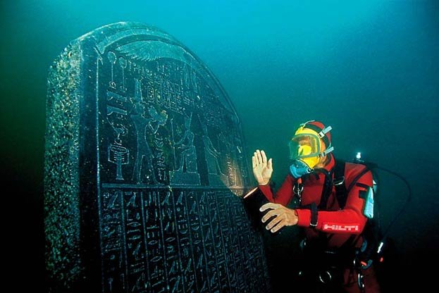
The underwater archaeologists found a massive statue of Hapi, the god responsible for the Nile's inundation, that stood 5.4 meters (17.7 feet) tall among the ruins of the once-great metropolis. This was one of three enormous red granite statues from the fourth century BC that were found. A prehistoric stele with intricate and easily visible writing that was originally commissioned by Nectanebo I sometime between 378 and 362 BC was also found by the researchers in 2001.

Because Thonis was the name originally given to the city by the Egyptians while Heracleion was given by the ancient Greeks, it was possible for archaeologists to deduce from the writings on this old stele that Thonis and Heracleion were one and the same ancient city. The ancient city's name was changed to Thonis-Heracleion at that point.

Many statues and buildings that once stood tall and majestic in the great city may be seen in the breathtaking photos taken throughout the finding and recovery operation. In one image, a statue of a Ptolemaic queen made in Greco-Egypt stands eerily on the ocean floor, surrounded only by silt and darkness, while in another, the visage of a famous Pharaoh can be seen peeking up out of the sand.

Franck Goddio stated that the goal of the IEASM underwater excavations was "to learn as much as we can by touching as little as we can and leaving it for future technology" in an interview with the BBC in 2015. Around 2% of the site had been excavated at that time. The same clay deposit from the Nile that has long concealed the ancient city also shields the relics on the ocean floor from salt water.

IEASM takes great care to restore and preserve artifacts that are taken from their secret underwater refuge on board their ships and in laboratories. This process has taken days in some cases, while it took two and a half years to complete the massive Hapi monument, for example.

Knowing the causes of cities sinking into the sea

The metropolis, which was built on the Nile Delta, was considered to be breathtakingly beautiful and was crisscrossed by a massive network of canals. Heracleion, known as the Venice of the Nile, once held the title of the greatest harbor in the Mediterranean. The city apparently gradually lost importance as it disappeared under the water around the second half of the eighth century AD, according to excavations at the site. This raises the issue of why such an important city was destroyed.

A number of geological phenomena and cataclysmic occurrences are the causes. Geological studies conducted by the IEASM in collaboration with other institutions have revealed that the slow subsistence, the rise in sea levels, and regional phenomena related to the composition of the soil in the region all had an impact on the southeastern Mediterranean basin, creating the conditions for cities like Heracleion to sink into the sea.

Egypt's Lost Worlds exhibits

The Egyptian government, which owns the artifacts, granted IEASM permission in 2005 to organize a traveling display of the finds. Egypt's Sunken Treasures, the exhibition that resulted, traveled to significant cities in Germany, Spain, Italy, and Japan. A record 7,500 people each day, on average, visited the show at the Grand Palais in France.

The British Museum and Franck Goddio collaborated to organize the first underwater archaeological exhibition in 2015, which featured over 200 objects found between 1996 and 2012 by the IEASM off the coast of Egypt. At that point, according to Goddio, they had only discovered 5% of the 3.5 sq. km.-sized ancient metropolis of Heracleion (1.35 miles).

Goddio reportedly said that while "this would be a tremendous project on land, it's a task that will take hundreds of years under the sea and beneath the silt," according to The Art Newspaper. Heracleion is around three times the size of Pompeii, a catastrophic site that archaeologists have been excavating for more than a century, so you can get an idea of the scope of this undertaking.

The Sunken Cities: Egypt's Lost Worlds exhibition at the British Museum was also shown in 2015 at the Institut du Monde Arabe in Paris and the Saint Louis Art Museum in the United States. Before the items were sent back to Egypt in January 2021, they made their final stop at the Virginia Museum of Fine Arts.

The discovery of Heracleion prompts critical inquiries concerning the veracity of purported "mythical towns." Who knows what other mythical sunken cities from the past will be discovered in the future if a city that was previously thought to be mythical can be found in the depths of the sea? Time will only tell.

Pavlopetri, Greece: This 5,000-Year-Old Town Discovered Underwater

Underwater discoveries, from sunken civilizations to the millions of shipwrecks still undiscovered on the seabed, capture the interest of history buffs like nothing else. With less than 1% of the ocean floor having been explored so far, the world's oceans and seas have been dubbed the largest museum in the world. Some contend that the Bronze Age port of Pavlopetri's ruins, which were only recently found, may have served as the inspiration for the mythical tale of Atlantis.

Finding of Pavlopetri: The World's Oldest Underwater Town

The remnants of a submerged settlement thought to have existed as long ago as 5,000 years ago were unearthed in the 1960s by Nic Flemming from the Institute of Oceanography at the University of Southampton. The archaeological site, which is 4 meters (13.12 feet) below and is situated close to the little village of Pavlopetri in the Peloponnesus region of southern Greece, is currently thought to be the oldest known planned underwater town in the entire world. Thus, it joined the company of other enigmatic underwater colonies, towns, and cities that have captivated the interest of history buffs, such as:

  • Shi Cheng, an ancient Chinese city, is immaculately preserved (the Lion City)

  • India's fabled sunken temples at Mahabalipuram

  • Heracleion, an ancient Egyptian city

  • Israel's Atlit Yam Neolithic site, which dates back 9,000 years

  • Jamaica's Port Royal, a city of pirates during the 17th century

The site was first recognized by geologist Folkion Negris in 1904, but after Flemming rediscovered it, a group of archaeologists from the University of Cambridge investigated it in 1968. The University of Nottingham then started a five-year project to research the town of Pavlopetri in 2009, overseen by John C. Henderson, in collaboration with the Hellenic Centre for Marine Research and the Ephorate of Underwater Antiquities of the Greek Ministry of Culture and Tourism.

In order to examine the seabed and bring the historic town back to life before the fragile remnants are lost forever as a result of lack of protection, pollution, waves, currents, and tourists, the Pavlopetri Underwater Archaeological Project was created. Pavlopetri was the first underwater village to be digitally scanned in 3D using sonar mapping technology as a result of the project. They were able to create amazing photorealistic 3D digital reconstruction photos thanks to the confluence of cutting-edge marine science with movie industry computer graphics, which transformed underwater archaeology.

What did they discover at Pavlopetri?

The study project discovered thousands of items at the location that shed light on daily life at Pavlopetri between 3000 and 1100 BC, when it "sank," perhaps as a result of localized earthquakes, erosion, rising sea levels, or even a tsunami. The first evidence of a sunken metropolis in Greece that precedes Plato's account of Atlantis can be found there.

Pavlopetri, a representation of life 5,000 years ago, was exceptionally well planned, with streets, two-story homes with gardens, temples, cemeteries, and a sophisticated water management system with channels and water pipelines. The majority of the structures in the city's center had up to 12 rooms inside, and there was even a square or plaza that was roughly 40 by 20 meters (131 by 65 feet) in size. Its uniqueness was emphasized by Dr. Jon Henderson of the University of Nottingham team, who oversaw the Pavlopetri Underwater Archaeological Project. "There are older sunken sites around the globe, but none can be considered to be planned communities such as this," he said in The Guardian.

The renowned ancient Greek epic poem Iliad was set in a time when the city was so old that it had already existed at that time. According to research conducted in 2009, the site is around 9 acres (36,421 m2) in size, and there is evidence that it was occupied as early as 2800 BC. At least 15 buildings have been discovered, and the city's layout is still plainly discernible despite having sunk so long ago. The layout of the city is so obvious that the leader of the Nottingham archaeological team was able to construct what they consider to be an incredibly realistic 3D replica of the city.

According to historians, the ancient city served as a hub for trade between the Mycenaean and Minoan civilizations. Large clay storage containers, statues, common objects, and other relics can be found all around the site.

The city's original name, as well as its precise function in the ancient world, are unclear. According to Elias Spondylis of the Greek Ministry of Culture in the New Scientist, "It's a rare find, and it is significant because, being a submerged site, it was never reoccupied and hence symbolizes a frozen moment of the past."

Today’s condition of the site

The Pavlopetri site has focused its coverage of the world's most frequently explored seafloor on safeguarding the artifacts. The University of Nottingham team employed technology to construct a photorealistic representation of the seabed in a magnificent BBC program from 2011 titled Pavlopetri: The City Under the Waters. To support local conservation and protection efforts, including a Watch Day hosted by the Greek Chapter of ARCH International to raise awareness of the site, Pavlopetri was added to the World Monuments Watch in 2016 as a way to conserve heritage sites that are in danger.

Since then, the Watch Day has included the Pavlopetri Eco-Marine Film Festival, which presents motion pictures and documentaries about the marine environment and offers snorkeling trips beneath the surface of the old city. As a result of these activities, the region was buoyed in August 2016 to protect it from small vessels, and in 2018, it became the first location in Greek waters to be listed on marine charts that the Greek Navy's Hydrographic Department provides to mariners.

Ancient Shipwreck dating back to the 2nd century BC was discovered off the coast of Croatia

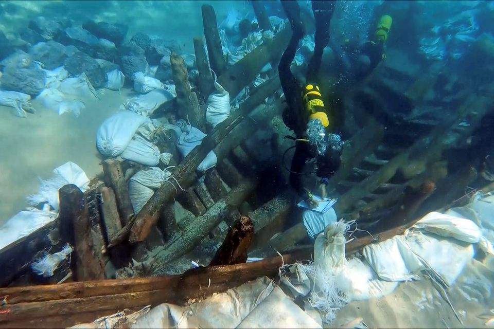
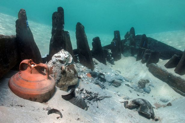
Did you know that the best-preserved shipwreck is from the 2nd century BC and was found in the waters surrounding Losinj near the island of Ilovik? This important archeological discovery was discovered at a depth of only two and a half meters, and previously undertaken research has confirmed that it is indeed the oldest ancient ship ever discovered in the Adriatic.

As Morski writes, this ancient wooden ship was built using the technique of "joining grooves and tabs", and in the process of its creation, the formwork was first constructed, and then the skeleton of the ship was placed onto it, all of it connected by wooden wedges.

It is merchant ship that sailed along an important maritime route, right next to the island of Ilovik in Croatia. The ship is between 20 and 25 metres long, and given that it sank into its watery grave at a depth of a mere two and a half metres, it is a real miracle that it remained so well hidden for centuries.

The ship was discovered quite by accident by Slovenian archaeologist Milan Eric while anchoring in this particular Ilovik bay. After that, the research started, which has been being conducted since 2018 by the Department of Underwater Archeology of the Croatian Restoration Institute, in cooperation with French colleagues from the University of Marseille (Aix-Marseille University, the French National Centre for Scientific Research (CNRS), and the Camille Jullian Centre), and the Losinj Museum. This is all being done with the logistical support of the Diving Centre of the Special Police of the Ministry of the Interior of the Republic of Croatia (MUP) and the Subseason Diving Centre.

The research procedure in the waters surrounding Ilovik was carried out by the most modern methods of documentation, using photogrammetric techniques. The movable archeological material found on the ancient sunken ship confirms the dating of the ship's wood, which undoubtedly belongs to the older horizon of ships sailing the Adriatic, and testifies to the importance of the Losinj archipelago in the context of ancient waterways.

The site of this ship near Ilovik is extremely significant because of the shipbuilding tradition to which we attribute it, its dating, the ship's cargo and the very shallow working conditions that both facilitate and complicate research and pose a challenge to preserve the site. Since it is a site on loose sand, the archeological excavation itself was difficult due to the constant backfilling of the site, so a dam was built in parallel with the excavation,'' they said from the Losinj Museum.

Upon completion of the research and the preparation of documentation, the remains of the ''Ilovik ship'' were covered with sand, geotextiles, then again with sand and with iron nets, which are connected by concrete blocks. The movable archeological finds discovered there were brought back up to the surface, added to the list of finds, and were stored in the premises of the Croatian Air Force in Split during the desalination process.

Upon the completion of the conservation and restoration works, the findings from the Ilovik wreck will be stored in the Losinj Museum.

Source: https://www.total-croatia-news.com/lifesty...

Explore Baia – the ancient Roman city sunk deep under the sea for more than 500 years

Baia was the Las Vegas of the Roman Empire – the place where the rich and powerful came to carry out their illicit affairs.

Rome’s ultra-wealthy took weekend trips here to party. Powerful statesmen built luxurious villas on its beach, with heated spas and mosaic-tiled pools where they could indulge their wildest desires. One resident even commissioned a nymphaeum - a private grotto surrounded by marble statues, dedicated solely to ‘earthly pleasure’.

More than 2,000 years ago, Baia was the Las Vegas of the Roman Empire – a resort town approximately 30km from Naples on Italy’s caldera-peppered west coast that catered to the whims of poets, generals and everyone in between. The great orator Cicero composed speeches from his retreat by the bay, while the poet Virgil and the naturalist Pliny maintained residences within easy reach of the rejuvenating public baths.

It was also the place where the rich and powerful came to carry out their illicit affairs.

“There are many tales of intrigue associated with Baia,” said John Smout, a researcher who has partnered with local archaeologists to study the site. Rumour has it that Cleopatra escaped in her boat from Baia after Julius Caesar was murdered in 44BC, while Julia Agrippina plotted her husband Claudius’ death at Baia so her son Nero could become emperor of Rome.

“She poisoned Claudius with deadly mushrooms,” Smout explained. “But he somehow survived, so that same night, Agrippina got her physician to administer an enema of poisonous wild gourd, which finally did the trick.”

Mineral waters and a mild climate first attracted Rome’s nobility to Baia in the latter half of the 2nd Century BC, and the town was known to them as the Phlegraean (or ‘flaming’) Fields, so named because of the calderas that pockmark the region.

“I visited the site as a boy and the guide poked an umbrella into the ground and steam and lava came out,” Smout recalled.

The calderas were revered by the ancient Greeks and Romans as entrances to the underworld, but they also fuelled a number of technological advancements: the local invention of waterproof cement, a mixture of lime and volcanic rock, spurred construction of airy domes and marbled facades, as well as private fish ponds and lavish bath houses.

But given Baia’s sinful reputation, it is perhaps fitting that the abundance of volcanic activity in the area was also its downfall. Over several centuries, bradyseism, the gradual rise and fall of the Earth’s surface caused by hydrothermal and seismic activity, caused much of the city to sink into a watery grave, where it still sits today.

Tourist interest in the once-popular coastline was only renewed in the 1940s when a pilot shared an aerial photo of an edifice just below the ocean’s surface. Soon, geologists puzzled over boreholes left by molluscs on ruins found near the shore, tell-tale signs that parts of the hillside had once dipped below sea level. Two decades later, Italian officials commissioned a submarine to survey the underwater parts of the city.

What they found was fascinating: since Roman times, underground pressure has caused the land surrounding Baia to continuously rise and fall, pushing the ancient ruins upwards towards the sea’s surface before slowly swallowing them again – a kind of geological purgatory.

The ruins beneath the sea’s surface were the province of just a few intrepid archaeologists until recently. The underwater archaeological site was not formally designated a marine protected area and until 2002, which is when it opened to the public. Since then, 3D-scanning technology and other advances in marine archaeology have offered first-time glimpses into this chapter of antiquity: divers, historians and photographers have captured submerged rotundas and porticos, including the famed Temple of Venus (not a temple, but a thermal sauna) - discoveries that have in turn provided clues to Rome’s most outrageous debauchery.

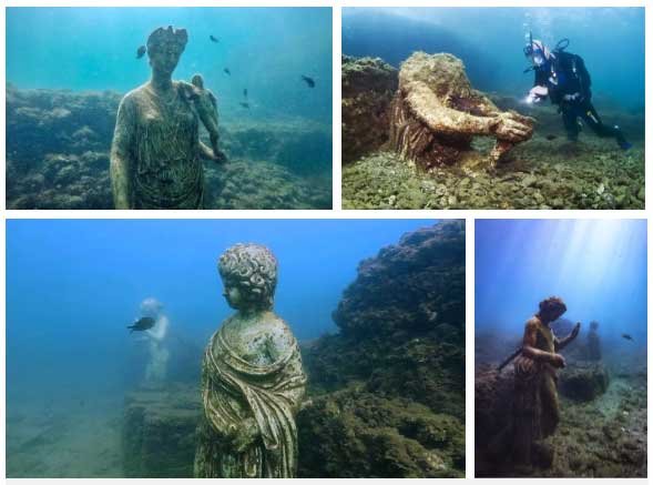
Because of the undulation of the Earth’s crust, these ruins actually lie in relatively shallow water, at an average depth of 6m, allowing visitors to see some of its eerie underwater structures from a glass-bottomed boat, or videobarca. Local diving centres such as the Centro Sub Campi Flegreo (who partnered with the BBC on a recent documentary about Baia) also offer snorkelling and scuba tours of the submerged city a few kilometres out in the Tyrrhenian Sea. On a calm day, visitors can spot Roman columns, ancient roads and elaborately paved plazas. Statues of Octavia Claudia (Emperor Claudius’ sister) and Ulysses mark the entrance to underwater grottos, their outstretched arms flecked with barnacles.

There’s plenty to see above the water line, as well. In fact, many of the submerged sculptures are actually replicas; the originals can be found up the hill at the Baia Castle, where the Archaeological Superintendency for Campania manages a museum of relics pulled from the sea. Many above-ground Roman ruins are also visible nearby at the Parco Archeologico delle Terme di Baia, the portion of the ancient city still above sea level.Excavated in the 1950s by Amedeo Maiuri, the archaeologist who also unearthed Pompeii and Herculaneum, the on-land historical site features the remains of mosaic terraces and domed bathhouses.

Surrounding the Parco Archeologico delle Terme di Baia, modern Baia is a shadow of its former magnificence, though it still captures the spirit of idleness and pleasure. These days the coastline that was once peppered with mansions and bathhouses features a small marina, a hotel and a handful of seafood restaurants lining a narrow road running north-east toward Naples.

Time may be running out to see this lost relic of ancient Italy’s opulence: seismologists predict further volcanic activity along Baia’s coast in the near future, rendering the city’s fate uncertain once again. Twenty small earthquakes were recorded in the area this past year alone, and talk in recent years has touched on permanently closing the sunken ruins to visitors.

For now, however, visitors can search this underwater city for a hidden entrance - if not to the underworld, then at least to some spectacular subterranean treasures.

Source: https://www.bbc.com/travel/article/2018010...

Two freedivers led archeologists to a treasure trove of 53 perfectly preserved ancient Roman coins

Two amateur divers swimming along the Spanish coast have discovered a huge hoard of 1,500-year-old gold coins, one of the largest on record dating to the Roman Empire.

The divers, brothers-in-law Luis Lens Pardo and César Gimeno Alcalá, discovered the gold stash while vacationing with their families in Xàbia, a coastal Mediterranean town and tourist hotspot. The duo rented snorkeling equipment so they could go freediving with the goal of picking up trash to beautify the area, but they found something far richer when Lens Pardo noticed the glimmer of a coin at the bottom of Portitxol Bay on Aug. 23, El País reported.

When he went to investigate, he found that the coin "was in a small hole, like a bottleneck," Lens Pardo told El País in Spanish. After cleaning the coin, Lens Pardo saw that it had "an ancient image, like a Greek or Roman face." Intrigued, Lens Pardo and Gimeno Alcalá returned, freediving to the hole with a Swiss Army knife and using its corkscrew to unearth a total of eight coins.

Stunned by the find, Lens Pardo and Gimeno Alcalá reported it the next day to the authorities. "We took the eight coins we had found and put them in a glass jar with some sea water," Lens Pardo said. Soon, a team of archaeologists from the University of Alicante, the Soler Blasco Archaeological and Ethnological Museum and the Spanish Civil Guard Special Underwater Brigade, in collaboration with the Town Council of Xàbia, came together to excavate and examine the treasure.

With the help of the archaeologists, they found that the hole held a hefty pile of at least 53 gold coins dating between A.D. 364 and 408, when the Western Roman Empire was in decline. Each coin weighs about 0.1 ounces (4.5 grams).

The coins were so well preserved, archaeologists could easily read their inscriptions and identify the Roman emperors depicted on them, including: Valentinian I (three coins), Valentinian II (seven coins), Theodosius I (15 coins), Arcadius (17 coins), Honorius (10 coins) and an unidentified coin, according a University of Alicante statement. The hoard also included three nails, likely made of copper, and the deteriorated lead remains of what may have been a sea chest that held the riches.

The hoard is one of the largest known collections of Roman gold coins in Europe, Jaime Molina Vidal, a professor of ancient history at the University of Alicante (UA), researcher at the University Institute of Archaeology and Historical Heritage at UA and team leader who helped recover the buried treasure, said in the statement. The coins are also a treasure trove of information, and may shed light on the final phase of the Western Roman Empire before it fell, Molina Vidal said. (In A.D. 395, the Roman Empire split in two pieces: the Western Roman Empire, with Rome as its capital, and the Eastern Roman, or Byzantine, Empire, with Constantinople (modern-day Istanbul) as its capital, Live Science previously reported.)

Perhaps these coins were purposefully hidden during the violent power struggles that ensued during the Western Roman Empire's final stretch. During that time, the barbarians — non-Roman tribes such as the Germanic Suevi and Vandals and the Iranian Alans — came to Hispania, the Roman name for the Iberian Peninsula, and took power from the Romans in about 409, according to the statement.

"Sets of gold coins are not common," Molina Vidal told El País, adding that Portitxol Bay is where ships leaving from Rome's Iberian provinces stopped before sailing to the Balearic Islands, which includes modern-day Mallorca and Ibiza, and then heading to Rome. Given that archaeologists haven't found evidence of a nearby sunken ship, it's possible that someone purposefully buried the treasure there, possibly to hide it from the barbarians, likely the Alans, he said.

"The find speaks to us of a context of fear, of a world that is ending — that of the Roman Empire," Molina Vidal said.

So far, a study of the coins suggests that the gold hoard belonged to a wealthy landowner, because in the fourth and fifth centuries "the cities were in decline and power had shifted to the large Roman villas, to the countryside," Molina Vidal told El País.

"Trade has been stamped out and the sources of wealth become agriculture and livestock," he said. As the barbarians advanced, perhaps one of the landowners gathered up the gold coins — which did not circulate as regular money, but were collected by families to serve as signs of wealth — and had them buried in a chest in the bay. "And then he must have died because he did not return to retrieve them," Molina Vidal said.
Source: https://www.livescience.com/divers-find-ro...

Divers Uncover Ancient Temple Submerged Within The ‘Egyptian Atlantis’

The remnants of the ancient submarine temple were found in the ancient sunken town of Heracleion, off the north coast of Egypt, identified as the Atlantic of Egypt.

About 1,200 years ago the town sank into the sea but after it was discovered 2,000 marine archaeologists have been probing to uncover new parts of the settlements.

In the most recent discovery, Egyptian and European divers uncovered the ruin of a temple along with several boats holding treasures like bronze coins and jewellery.

Using a sophisticated scanning device, they revealed a new part of the city’s main temple, which has been completely destroyed. Remains of a smaller Greek temple, complete with ancient columns was found along with pottery from the third and fourth centuries B.C.E.

The bronze coins were from the reign of King Ptolemy II (283 to 246 BCE). Archaeologists also stretched their map of Canopus—another sunken settlement close to Heracleion.

They found the remains of several buildings, expanding the city by about two-thirds of a mile along with gold and bronze coins as well as jewellery including rings and earrings.

The team believe the artefacts date from the Ptolemaic dynasty (305 to 30 B.C.E) to the time of the Byzantine Empire, which began in 330 C.E. Researchers also investigated some of the many ancient ships known to exist at the site.

They found treasures including crockery, coins and jewellery in one now fully-excavated vessel. The team believe the wreck dates from the fourth century B.C.

The city of Heracleion, home of the temple where Cleopatra was inaugurated, was one of the most important trade centres in the Mediterranean area before it disappeared into what is now the Bay of Aboukir.

But 12 years ago, underwater archaeologist Dr Franck Goddio was searching the Egyptian coastline for French warships from the 18th century battle of the Nile, but instead stumbled across the treasures of the lost city.

After removing layers of sand and mud, divers discovered evidence of extraordinary wealth, painting a picture of what life was like in Heracleion, believed to have been at the centre of Mediterranean trade more than 1,000 years ago.

Although it was mentioned in classical texts, Heracleion lay undisturbed beneath the waters of Abu Qir Bay until it was mapped in 2000. Researchers spent four years charting the city, known as Thonis in Egypt, according to the lead researcher Franck Goddio.

After more than a decade of excavation, researchers were able to create a map depicting life in the ancient trade hub.

The research team, led by Dr Goddio have yet to establish what caused the city to go down, but the main theory is that the unstable sediments Heracleion was built on collapsed, and in combination with a rising sea-levels, may have caused the entire area to drop 12 feet straight into the water.

‘We are just at the beginning of our research,’ Dr Goddio told the Telegraph in 2013.

’We will probably have to continue working for the next 200 years.’

Source: https://archaeology-world.com/divers-uncov...

15th-century Baltic warship served as a 'floating castle' for an intrepid king

"Nothing else like this has been found."

One of the archaeologists excavating the Gribshunden, led by Sweden's Lund University, explores some of the ship's timbers. (Image credit: Brett Seymour)

A 15th-century royal warship resting off the coast of Sweden once served as a "floating castle" for an intrepid king, according to new underwater investigation that revealed cannons, handguns, crossbows and the vessel's stern superstructure.

The new finds on the wreck of the Gribshunden — the flagship of King Hans (or John) of Denmark until it sank in 1495 — show the vessel plied the seas as a fearsome ship of war armed with dozens of guns and packed with soldiers.

It's thought that the Gribshunden was armed with up to 90 early cannons, although they were much smaller than the ship-smashing cannons of the late 16th century, and that they were complemented by armored soldiers firing handguns and crossbows from the ship's upper deck, forecastle and sterncastle — the tall superstructures built at each end of the ship. 

The 115-foot-long (35 meters) wooden ship was one of the first vessels designed to carry artillery. It also utilized the new "carvel" shipbuilding technique, imported to the Baltic from the Mediterranean, of joining the planks of the hull edge to edge on a wooden frame instead of overlapping them in "lapstrakes."

That meant the Gribshunden could be built larger and stronger than ships with lapstrakes, and so it could carry more in heavier seas.

"This is kind of a new technology," Brendan Foley, a maritime archaeologist at Lund University in Sweden who is leading the latest excavations, told Live Science. "It was designed to carry artillery, and King Hans uses the ship in a way that no other king does."

The wooden hull and superstructures of the 500-year-old ship are in a remarkable state of preservation because the eastern Baltic Sea is too cold and brackish for shipworm to infest the wreck.(Image credit: Brett Seymour)

The Gribshunden was new technology for its time, with a hull built in the "carvel" style of planks fitted edge-to-edge that allowed it to be big enough to carry guns.(Image credit: Brett Seymour)

Royal flagship

From the mid-1480s, Hans frequently journeyed on the Gribshunden throughout his realm, often surrounded by a large royal fleet, Foley said, adding that the ship was intended to intimidate the king's rivals. 

The son of the previous Danish king, Hans ruled Denmark from 1481 and gained the crown of Norway in 1483, but Sweden didn't submit to his rule until 1497.

"His realm is Denmark and Norway, and he's trying to get Sweden to rejoin the Nordic Union," Foley said. "So Hans is sailing around on this ship all the time." (The Nordic Union of Denmark, Norway and Sweden was also called the Kalmar Union, after the town in Sweden where it was agreed in 1397.)

Hans embarked on the Gribshunden (which means "Griffin dog," although it originally seems to have been called "Griffon") for negotiations at Kalmar in 1495 when the ship mysteriously sank, supposedly after a fire broke out, at an anchorage just offshore near the town of Ronneby.

The king and his retinue were onshore at the time, but a witness to the disaster(opens in new tab) said many of the roughly 150 men onboard were killed.

Many of the ship's guns were probably salvaged soon after the sinking, Foley said; the latest excavations found only 14 gun carriages near the stern, but many more were likely situated near the bow.

A peculiarity of the eastern Baltic Sea is that it's too cold and brackish for infestations of shipworm (which is not a worm but a mollusk, Teredo navalis). Because of that, the wooden gun carriages are still intact, although the iron guns have rusted away, he said. 

But there was no sign of fire, so the ship probably sank quickly after being holed below the waterline, possibly because its stores of gunpowder had exploded. "It's one of the first ships carrying gunpowder, so they probably hadn't worked out standard operating procedures for safety," Foley said.

Floating castle

Local divers rediscovered the wreck of the Gribshunden near Ronneby in the 1970s, beneath about 33 feet (10 m) of water. It was identified in 2013, and in 2015, archaeologists recovered several artifacts, including the figurehead of a person clutched in the jaws of a dog or dragon, Live Science reported at the time. 

Foley led dives to the wreck in August and September, during which the team recovered more artifacts and captured three-dimensional data for a digital reconstruction.

The wreck is considered a proxy for the ships from the Age of Exploration, such as those of Christopher Columbus and Vasco da Gama, which were built at about the same time but are now lost. "Nothing else like this has been found," Foley said.

The combination of guns and crossbows, as well as the remnants of shirts of mail armor that were also found, show the transition from earlier weapons to gunpowder, he added.

The larger ship's guns were mounted on swivels within their wooden carriages and fired projectiles about the size of golf balls. Meanwhile, the handguns were very simple — about 16 inches (40 centimeters) long, with projectiles like musket balls that were fired by touching a match to a hole in the back. "They were basically like a small cannon," Foley said.

Fritz Jürgens, a maritime archaeologist at Kiel University in Germany isn't involved in the study of the Gribshunden, but he's leading research into a rare 400-year-old ship discovered in the outer stretches of the Trave River in the western Baltic. He noted that the Gribshunden is the oldest carvel-built ship ever found in the Baltic and one of the oldest purpose-built warships ever discovered.

"In the Middle Ages and in the later Hanseatic period [when a trading bloc dominated the Baltic, from the 13th to 17th centuries], they took normal cargo ships and put archers on it," Jürgens said. "But the Gribshunden had artillery on the forecastle and sterncastle — it was specifically built for war."

Editor's note: Updated at 12:24 p.m. EDT to note that the shipworm Teredo navalis copes well with low salinity (brackish waters), and also with low water temperature; but the combination of these two factors is what stops shipworm infestations in the eastern Baltic Sea.

Source: https://www.livescience.com/balctic-warshi...

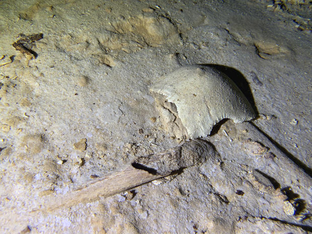
Cave diver discovers 8,000-year-old human skeleton left over from the last Ice Age

A prehistoric human skeleton has been found in a cave system that was flooded at the end of the last ice age 8,000 years ago, according to a cave-diving archaeologist on Mexico's Caribbean coast.

This photo shows fragments of a prehistoric human skeleton partly covered by sediment in an underwater cave in Tulum, Mexico, Sept. 10, 2022. The cave system was flooded at the end of the last ice age 8,000 years ago, according to an archaeologist and cave diver Octavio del Rio, and is located near where the government plans to build a high-speed tourist train through the jungle. OCTAVIO DEL RIO / AP

Archaeologist Octavio del Rio said he and fellow diver Peter Broger saw the shattered skull and skeleton partly covered by sediment in a cave near where the Mexican government plans to build a high-speed tourist train through the jungle.

Given the distance from the cave entrance, the skeleton couldn't have gotten there without modern diving equipment, so it must be over 8,000 years old, Del Rio said, referring to the era when rising sea levels flooded the caves.

"There it is. We don't know if the body was deposited there or if that was where this person died," said Del Rio. He said that the skeleton was located about 8 meters (26 feet) underwater, about a half-kilometer (one third of a mile) into the cave system.

Some of the oldest human remains in North America have been discovered in the sinkhole caves known as "cenotes" on the country's Caribbean coast, and experts say some of those caves are threatened by the Mexican government's Maya Train tourism project.

Del Rio, who has worked with the National Institute of Anthropology and History on projects in the past, said he had notified the institute of the discovery. The institute did not immediately respond to questions about whether it intended to explore the site.

But Del Rio said Tuesday that institute archaeologist Carmen Rojas told him that the site was registered and would be investigated by the institute's Quintana Roo state branch Holocene Archaeology Project.

He stressed that the cave — whose location he did not reveal because of a fear the site could be looted or disturbed — was near where the government has cut down a swath of jungle to lay train tracks, and could be collapsed, contaminated or closed off by the building project and subsequent development.

"There is a lot more study that has to be done in order to correctly interpret" the find, Del Rio said, noting that "dating, some kind of photographic studies and some collection" would be needed to determine exactly how old the skeleton is.

Aquatic archaeologist Octavio del Rio films a prehistoric human skeleton partly covered by sediment in an underwater cave in Tulum, Mexico, Sept. 10, 2022. PETER BROGER / AP

Del Rio has been exploring the region for three decades, and in 2002, he participated in the discovery and cataloguing of remains known as The Woman of Naharon, who died around the same time, or perhaps earlier, than Naia — the nearly complete skeleton of a young woman who died around 13,000 years ago. It was discovered in a nearby cave system in 2007.

President Andrés Manuel López Obrador is racing to finish his Maya Train project in the remaining two years of his term over the objections of environmentalists, cave divers and archaeologists. They say his haste will allow little time to study the ancient remains.

Activists say the heavy, high-speed rail project will fragment the coastal jungle and will run often above the fragile limestone caves, which — because they're flooded, twisty and often incredibly narrow — can take decades to explore.

Caves along part of the coast already have been damaged by construction above them, with cement pilings used to support the weight above.

The 950-mile (1,500-kilometer) Maya Train line is meant to run in a rough loop around the Yucatan Peninsula, connecting beach resorts and archaeological sites.

The most controversial stretch cuts a more than 68-mile (110-kilometer) swath through the jungle between the resorts of Cancun and Tulum.

Del Rio said the route through the jungle should be abandoned and the train should be built over the already-impacted coastal highway between Cancun and Tulum, as was originally planned.

López Obrador abandoned the highway route after hotel owners voiced objections, and cost and traffic interruptions became a concern.

"What we want is for them to change to route at this spot, because of the archaeological finds that have been made there, and their importance," said Del Rio. "They should take the train away from there and put it where they said they were going to build before, on the highway ... an area that has already been affected, devastated."

Source: abc news

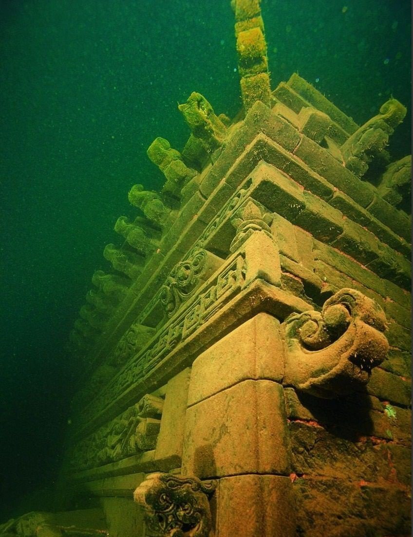
The China's Atlantis – 'Shi Cheng', An Ancient Underwater Lost City

Βelow the calm surface of Qiandao Lake in the Zhejiang Province of China lie the mysterious ruins of two ancient underwater ‘lost’ cities, dating back to the Han and Tang dynasties.

(Chinese National Geography)

Shī Chéng (Chinese: 狮城, literally ‘Lion City’) is an ancient underwater city situated under Qiandao Lake in the Zhejiang Province of China. The city was flooded for the purpose of Industrialization by the Chinese Government in the year 1959 after a hydroelectric dam was required for the province of Zhejiang.

Qiandao Lake, also known as Thousand Island Lake, is a sprawling body of fresh water, covering 573 sq. km. The name comes from the fact that there are over a thousand islands in the lake.

According to the evidence found, the lost city was inhabited for centuries, but is now primarily used as an underwater tourist attraction by tourists and diving experts.

Shī Chéng was named the 'Lion City' after the nearby Wu Shi Mountain (Five Lion Mountain) in the Qiandao Lake.

Origins and Discovery

Aerial view of Qiandao Lake. Photo by Chinese National Geography.

Shī Chéng was purposely flooded to create space for a hydroelectric dam on government orders. Approximately 300,000 people were relocated as a result of the project. The former residents were connected with the Lion City by basis of ancestry and culture.

(Chinese National Geography)

Shī Chéng was believed to be the most prominent Chinese city that remains well-preserved. Many of its homes, temples structures and paved roads were preserved by being 131 feet underwater. In this way, it was protected from wind, rain and sun damage.

(Chinese National Geography)

It is believed the city of Shi Cheng was built during the Tang Dynasty in 621 AD, making it nearly 1,400 years old. Based on records of the region’s history, it is thought to be quite large, possibly over 60 football fields, and featured 265 arches throughout the city. 

(Chinese National Geography)

Shi Cheng was also unusual in that it was constructed with 5 city gates and towers, as opposed to the norm of 4.  The city of He Cheng is believed to date back even further to the Han Dong dynasty (25 -200 AD).  

(Chinese National Geography)

The city has five entrance gates, which is different than the traditional four. The stone architecture dates to the Ming and Qing dynasties. Shī Chéng's streets contain 265 archways with surviving stonework that date to 1777, and the city walls date to the 16th Century.

The Chinese government planned an expedition to explore the remains of the lost metropolis in 2001, when the city was rediscovered. In 2011, pictures and graphics were published by the Chinese National Geography, which sparked interest among the general public and researchers to explore.

(Chinese National Geography)

The early divers found Shi Cheng to be largely intact, with many of the structures, carvings, guardian lions, and arches still preserved. There have been efforts to map & document Shi Cheng by divers and researchers, as well as looking into protective measures to prevent damage to it. The cities were declared historical relics under the protection of the Zhejiang Province.

HOW TO GET THERE

There are very few dive operators running trips to Qiandao Lake. I opted to dive with Big Blue Scuba, based in Shanghai, as they have scheduled trips to dive the lake. In addition, Shanghai has a wide range of travel and accommodation options, along with many international and domestic flights to either Pudong Interational Airport (PVG) or Shanghai Hongqiao International Airport (SHA).


The Qiandao Lake dives were offered as a weekend package, including round trip transport between Shanghai and the lake, the dives, tanks and weights, food, and local accommodations. Nitrox and rental gear is available if needed.

From Shanghai it is approximately 400km to the small town of Dashuzhen near the southwestern edge of the lake, taking between 6-7 hours by car.  It was actually only 4 hours to reach the eastern edge of Qiandao Lake, however, you will still needed to navigate the local winding roads around the lake (some of which were still under construction) to reach the hotel in Dashuzhen.

(Chinese National Geography)

Another option is to contact the Beijing Dragon Diving Club to see if they have any upcoming Qiandao Lake dives. Members of the club were the first to rediscover the underwater city in 2001.

Because this is a lake dive, it is important to understand the differences between the conditions encountered here vs. clear ocean water. All divers were required to do an initial checkout dive in the lagoon, which only reached around 25ft in depth. Visibility at the surface was 5ft at best, dropping down to a mere 6 inches in some places at the bottom of the lagoon.

(Chinese National Geography)

This quickly made us realize how quickly the visibility could deteriorate, how easily you could become separated from your guide and how disorienting the conditions could become. If any group members had lapses in buoyancy or improper kicking technique that disturbed the low solubility sediment at the ruins, the dive could be completely destroyed for everyone.

PHOTO GALLERY BY CAROLYN WANG

The dive boat can hold 6-8 divers and was docked in the lagoon near the dive staging area where we prepped our gear and suited up. Bathrooms and showers are located at the staging area as well. The Lion City dive sites are about 10 minutes by boat from the dock, and we dove as a group of 3 with our guide. The lake itself becomes dark very quickly as you descend, and dive lights are mandatory as it essentially becomes a night dive as you near the ruins, which lie between 85 – 130ft below.

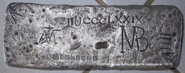
50kg Silver Bar Found in Madagascar – May Be Treasure of Legendary Pirate Captain Kidd

Underwater explorers believe they have discovered treasure belonging to the notorious 17th-Century Scottish pirate William Kidd in the waters off Madagascar.

A 50 kg block of silver with inscriptions, which is now under armed guard on Sainte Marie island off the east coast of Madagascar. The bar was presented to Madagascar's president at a special ceremony in 2015.

The bar is imprinted with a ‘T’ and ‘S’ on one side and letters and numbers on the other, the meaning of which is currently unknown.


The joint U.S./U.K. archaeological research team believe there are many more such bars still in the wreck.


Captain William Kidd (1645 –1701) was a Scottish sailor who was tried and executed for piracy after returning from a voyage to the Indian Ocean.

The 50kg silver bar found off the coast of Madagascar.

Presidence de la Republique de Madagascar.

One of the most infamous pirates of all time, Captain William Kidd was said to have amassed treasure worth £100,000 – £12 million now – before he was arrested for piracy and murder.
Scotsman Capt Kidd buried a cache somewhere on his travels and at his trial in London, in 1701, tried to barter his knowledge of its location in return for his life.

The Guardian reports that the silver bar was found in shallow waters off Sainte Marie island by a joint UK-US archaeological mission led by Barry Clifford, an underwater investigator who discovered the remains of William Kidd’s ship Adventure Galley in 2000.

Barry Clifford led a team which discovered the suspected treasure

He is typically perceived as either one of the most notorious pirates in history, or as one of its most unjustly vilified and prosecuted privateers. The latter view comes from the fact that his actions were allegedly less destructive and less lucrative than other pirates, yet he met a rather brutal end – he was hanged twice (the first attempt failed), before being covered in tar and hung from a gibbet over the river Thames.


“The son of a Presbyterian minister, Kidd was a buccaneer and a captain for a private British ship in the Caribbean for some years, but it is claimed he decided that he found piracy more rewarding after he was commissioned to sail to Madagascar on the Adventure Galley,” reports The Guardian.

“His most famous capture was a 400-tonne ship, the Quedah Merchant, which carried silver as well as silk, gold, sugar, opium and cloth.”

Kidd was captured in Boston in 1699 and sent to Newgate prison. The treasure found on his ship was valued at £30,000 (around £10 million today), but the remainder of his treasure was never found. The belief that Kidd had left buried treasure contributed considerably to the growth of his legend and has also given impetus to constant treasure hunts in places Kidd is known to have visited.

The treasure has never been found – but experts believe the bar of silver, itself worth more than £17,000 at today’s prices, could be part of the famous loot.

The fate of Capt Kidd’s treasure has prompted numerous hunts around the world over the last three centuries, and his exploits inspired author Robert Louis Stevenson when writing Treasure Island.

Mr Clifford presented the suspected treasure to Madagascar’s president, Hery Rajaonarimampianina and UK and US diplomats at a ceremony on the island.
Mr Vogl added that officials including UK ambassador to Madagascar, Timothy Smart, are hoping the discovery will ‘raise the profile of Madagascar, especially for tourists’.

Capt Kidd was tried not only for piracy but also on the accusation he murdered one of his crewmen in 1697.

His execution was not straightforward, with the noose around his neck twice breaking – but the third rope held firm.

It is believed that Kidd buried much of his treasure, with the legend going down in history in Robert Louis Stevenson’s

The wreck of Kidd’s Armenian ship Quedagh Merchant was found by archaeologists from the University of Indiana in 2007, after decades of competition between treasure hunters to uncover the 500-tonne vessel.

The ship was loaded with treasured satins, muslins, silver and gold that probably belonged to the British East India Company before being commandeered by Kidd in 1699.

The Race to Preserve Treasures From a Legendary 17th-Century Shipwreck

The new Bahamas Maritime Museum will feature finds from the “Maravillas,” a Spanish galleon that sank in 1656 with a cargo of gold, silver and gems

Divers from AllenX examines the debris trail of the Maravillas, which sank in the Bahamas in 1656. © Chad Bagwell / Allen Exploration

Sean Kingsley, Smithsonian

From August to December 1654, the Spanish galleon Nuestra Señora de las Maravillas (Our Lady of Wonders) waited in Cartagena, Colombia, for a cargo of silver that would never arrive. Unbeknownst to the ship’s crew, its supply vessel, the Jesus Maria de la Limpia Concepción, had sunk on a reef off Ecuador that October.

Only after the Concepción’s silver was salvaged and stowed on the Maravillas, alongside the galleon’s own fresh load of silver coins and bars, did the Lady of Wonders embark on its journey home to Spain. At the time, ships sailing between Europe and the Americas had to pass through the Bahama Channel, a shortcut between Florida and the Bahamas’ then-unmapped reefs. There, on January 4, 1656, the galleon lost its bearings.

Sailing as the vice-flagship of the Tierra Firme (Mainland) fleet, the Maravillas was rammed by its flagship and violently collided with a reef. The vessel sank like a stone, weighed down by its double cargo—the wreck of a wreck.

Today, the 891-ton Maravillas is the sunken crown jewel of the Bahamas, an island nation abounding in shipwrecks. Long exploited by treasure hunters, the 17th-century galleon is now being surveyed scientifically for the first time—an endeavor showcased in the Bahamas Maritime Museum, a privately owned institution slated to open in Freeport, Grand Bahama, on August 8.

“The Maravillas has never seen the right level of archaeological respect,” says David Gibbins, a marine archaeologist and bestselling novelist who is not involved in the ongoing excavations. “Past teams indiscriminately used smash-and-grab tactics. Everyone thought the ship, the wreck, was destroyed forever.”

Coins and high-status personal belongings, including gold jewelry, chain and pendants, recovered from the wreck of the Maravillas © Brendan Chavez / Allen Exploration

Exploring the Maravillas

Over 40 miles off the Little Bahama Bank, a group of scientists headed by philanthropist and explorer Carl Allen tows magnetometers (navigational devices that measure magnetic fields) across miles of seabed. Every find is plotted, from a shard of pottery to a cannon; currents are modeled, and seabed geology is assessed. Up in the air, an Icon A5 aircraft searches for scattered wreckage. Beneath the waves, a Triton submarine plummets down to 650 feet, eyes peeled for sections of the Maravillas that may have slipped into the abyss. Even with all hands on deck, the work is slow and painstaking.

Throughout history, the waters surrounding the Bahamas have been an infamous playground for treasure hunters. Founded by Allen in 2016, Allen Exploration (also known as AllenX) is the first team to study the Maravillas with scientific rigor. Allen, a multimillionaire who made his money through a plastics business, also owns a fleet of yachts and the Bahamian island of Walker’s Cay.

In 2019, the Bahamian government granted AllenX a license to explore the wreck, ending a moratorium on shipwreck salvage expeditions that had been in place since 1999. The company owns and operates the soon-to-open museum, which features finds from the Maravillas, as well as displays on local history and culture.

The Maravillas was built in the province of Guipúzcoa, today part of the Basque Autonomous Community in northern Spain, during the 1640s. It was named after a 13th-century sculpture of the Virgin Mary that was housed in a Carmelite convent in Madrid and famed for its miracles. The ship featured two decks, a chapel for mass and a golden lion figurehead. Stowed in its cargo hold were royal and private consignments and smuggled treasures.

The AllenX team records an iron anchor along the Maravillas shipwreck trail. © Brendan Chavez / Allen Exploration

Some 650 people—a mix of travelers, merchants and crew—were on board the Maravillas during its final voyage. After the ship was wrecked, enormous waves broke it into pieces. Most of the passengers grabbed hold of floating debris and drifted away, never to be seen again. About 150 clung to pieces of the hull still above the water, only to die from exposure or be eaten by sharks. By sunrise on January 5, only 45 remained alive.

Previously, many scholars believed the Maravillas had been salvaged into oblivion. The Spanish Empire had no intention of leaving a royal ransom sitting on the ocean floor. Between 1656 and 1679, Spain sent ten expeditions to salvage the wreck site. English, French, Dutch and Bahamian ships tried their luck with the wreck in the late 17th and 18th centuries. Modern treasure hunters hit the site hard between the 1970s and early 1990s. Over three centuries, around 3.5 million pieces of eight and an undisclosed but significant number of silver bars were salvaged.

Without accurate records for both the historic and modern salvages, exactly what was lifted and what was left behind is educated guesswork. AllenX’s experts discovered that some Spanish treasure hunters went to great lengths to conceal their sunken bonanza. One Captain Iriarte hid gold from his 1657 salvage and was sentenced to death by hanging. In 1661, the Spanish crown sued Juan Somovilla de Tejada and Gaspar de los Reyes Palacio for failing to declare one million pesos recovered from the wreck. Over the centuries, countless happy-go-lucky divers stuffed their breeches with coins from the site.

“AllenX reversing the past’s disrespectful quarrying of the wreck comes as a relief,” says Gibbins. “Finally, we can look forward with hope to some science answering research questions long thought dead and buried.”

To search for surviving traces of the wreck, AllenX used magnetometers, which identified 8,800 metallic hits (spots of potential interest) across a search area covering 11 by 5 miles. Clusters of cultural debris soon emerged: shards of Spanish olive jars and Chinese porcelain, iron straps used to rig cannons on gun decks, glass wine bottles, sword handles, silver coins, tobacco pipes, and jewelry. Together, the finds serve as a sunken porthole into the tail end of the Golden Age of Spain, a flourishing of art and exploration that spanned roughly 1500 to 1681.

According to James Sinclair, director of marine archaeology for the AllenX Maravillas project, the researchers are delving into the mystery of the ship’s demise by thoroughly mapping all of their finds. “This isn’t just forensic marine archaeology,” he says. “We’re also digging into former excavations, working out what previous salvage teams got up to, where and why. So much data has been lost from this ravaged wreck. It’s time to reverse those trends.”

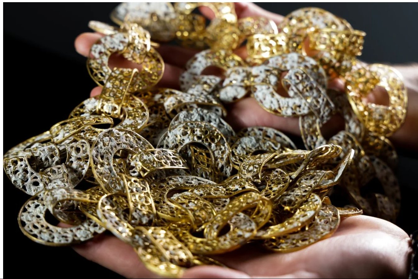
A unique golden filigree chain from the Maravillas, probably made in Manila, the Philippines © Nathaniel Harrington / Allen Exploration

The wreck’s rare treasures

Held annually since 1566, the Tierra Firme’s yearly sojourns to the New World had one main goal: to fill the fleet’s ships with riches from Latin America’s gold, silver and emerald mines, as well as copper, tobacco and Venezuelan pearls. Mined first by Indigenous peoples and then by enslaved Africans, these precious metals and gems helped fund the Franco-Spanish War, which began in 1635 and ended in 1659.

Though gold and silver “were a large part” of the Maravillas’ voyage, Allen says he feels a “greater connection with everyday finds than mass-produced coins. We’ve discovered artifacts that connect with the crew and passengers. … Everything you touch, from a musketball to a piece of jewelry, links with the past to people like you and me.”

A glass wine bottle discovered at the Maravillas wreck site © Brendan Chavez / Allen Exploration

A remarkable find made by the AllenX team is an almost 2-pound, 6-foot-long gold filigree chain crafted from circular flat and tubular links and decorated with rosettes. A similar chain appears in a portrait of Philip IV of Spain, who was on the throne when the Maravillas sank. The jewelry’s ornate appearance hints that it was commissioned by an elite client—perhaps even a royal one.

During the 17th century, merchants sometimes used individual gold chain links as currency. “This, however, cannot be said of the Maravillas’ chains,” notes Beatriz Chadour-Sampson, a jewelry historian and curator who has examined photos of the finds. “These are of high-quality craftsmanship, almost certainly made in Spanish Manila in the Philippines, possibly by Chinese craftsmen.”

Gusman sword guard © Brendan Chavez / Allen Exploration

Chadour-Sampson adds, “Such chains are a rare survival, as almost all were later melted down to be refashioned.”

The star finds from AllenX’s three years of underwater surveys are tiny jewels, no more than two inches long, found on top of dead coral reefs. “Exploring the debris field veering away from the Maravillas’ strike point”—where the boat was wrecked—“is a mixed feeling,” says Allen. “The sea bottom is barren. The colorful coral that divers remembered from the 1970s is gone, poisoned by ocean acidification and choked by shifting sand. It’s painfully sad. Still lying on those dead grey reefs, ... here and there, are sparkling finds.”
Uncut emeralds and amethysts, neither of which are listed on the Maravillas’ Spain-bound cargo, are especially common. Spanish galleons returning from the Americas often carried contraband at least 20 percent above what was declared, and sometimes as much as 200 percent over. Smuggling was a national sport.

Gold and bezoar stone scallop-shaped pendant of the Order of Santiago, with a cross of St. James at center © Nathaniel Harrington / Allen Exploration

“[This] galleon was stuffed with contraband illegally greasing the palms of Spanish merchants and officials,” Allen says. “Our [surveys are] finding that most recovered coins were minted in Mexico. But the Maravillas didn’t officially load coins in Mexico.”

In addition to smuggled loot, the ship carried personal items and rare objects ready to be sold to wealthy Europeans. Among these privately owned treasures was a golden pendant shaped like a scallop shell and adorned with the cross of Santiago, or Saint James. The pendant is backed with an Indian bezoar stone, famous in Europe for its healing properties. At the center of a second golden pendant, this one oval in shape, is a gold cross of Saint James atop a large Colombian emerald. The outer edge is framed by 12 square emeralds, perhaps symbolizing the 12 apostles.

AllenX has so far tied four finds—including three pendants—to the Order of Santiago, Spain and Portugal’s most prestigious military body. They were likely owned by high-ranking officers on the Maravillas, as the order’s knights were especially active in the sea trade. When Portuguese navigator Vasco da Gama, the first European to sail to India, commanded a 21-ship armada in 1502 and 1503, it sailed with eight Santiago knights. Martin de Urnieta, the shipwright who finished building the Maravillas in 1647, was also a knight of the order.

The jewelry’s scalloped shape was designed to replicate the scallops picked up along the coast of Galicia, in northwest Spain, and carried home by pilgrims who visited the shrine of Santiago de Compostela. Built by Spain’s Alfonso III in 899 C.E., the pilgrimage destination supposedly housed Saint James’ bones. During the medieval era and beyond, knights of the Order of Santiago were charged with protecting the 500-mile pilgrimage route from attack by the Moors.

“Finding so many pendants linked to the Order of Santiago in varying designs and gemstones is incredibly rare on land,” says Chadour-Sampson. “They would have been strung around the neck on gold chains to show that pious owners had made a pilgrimage to Saint James’ shrine. … They make the decks of the Maravillas feel like a floating aristocratic court mixed with the sweat of sailors heaving on rigging.”

Gold and emerald pendant of the Order of Santiago, with a cross of St. James at center © Nathaniel Harrington / Allen Exploration

Sharing the Bahamas’ maritime history

Artifacts recovered from the Maravillas by AllenX form the bulk of the Bahamas Maritime Museum’s collection. Carl and his wife, Gigi Allen, have also donated materials salvaged by other teams in Bahamian waters between the 1970s and 1990s and acquired for the museum.

Next to the shipwrecked wonders are displays on a range of topics, including the Indigenous Lucayan peoples, the Bahamas’ little-known role in the transatlantic slave trade, and the island of New Providence’s infamous role in the golden age of piracy. The museum worked closely with the Bahamian government to plan these exhibits.

“For a nation built from the ocean, it’s astonishing how little is understood about the Bahamas’ maritime links,” says Michael Pateman, the museum’s director. “Few know that the … Lucayan peoples, for instance, settled here 1,300 years ago. Or that the whole population, up to 50,000 people, was forced out by Spanish guns, made to dive for pearls off Venezuela and killed off in less than three decades.”

Pateman adds, “There was a dazzling Old World culture in the Bahamas long before European ships thought they found a New World.”

Under the Antiquities, Monuments and Museum Act (amended in 2011), all wreckage in Bahamian waters is the property of the Bahamian government. AllenX is keeping all of its Maravillas finds together, conserved for display or storage in the museum. None of the artifacts recovered will be sold.

The museum’s goal is to share the Bahamas’ maritime legacy with Bahamians and the wider world. Visitors can watch artifacts from the wreck of the Maravillas being conserved through a glass window in an on-site lab; a museum education program teaches children about traditional boat building and archaeological techniques.

Since 2019, AllenX has discovered a total of 18 wrecks in the Bahamas. The company’s archaeologists are still searching for the Maravillassterncastle (a raised section of the ship), which probably broke off and drifted away before the galleon sank, and they plan to continue their work long after the museum opens its doors.

“I could spend my life looking for ships in the Bahamas and only scratch the surface of what’s down there,” says Allen. “There are wrecks here from the 1500s forward. And who knows what’s even earlier? These potential discoveries can help shape the story of the making of the Americas and the peoples that owned the land before colonial Europe arrived.”

Greece opens to Public Three Underwater Archaeological Shipwreck Sites

The underwater archaeological sites that can be visited are the late Roman shipwreck at Telegrafo Nion Sourpis, the Byzantine shipwrecks at Glaros Nion and Kikynthos Amaliapolis.

The late Roman shipwreck at Akrotiri Glaros

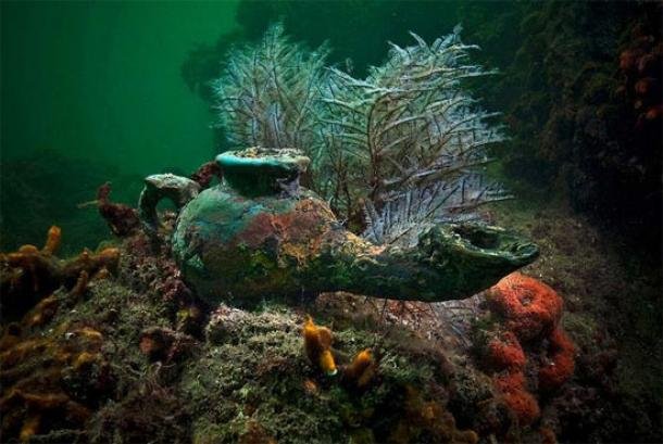
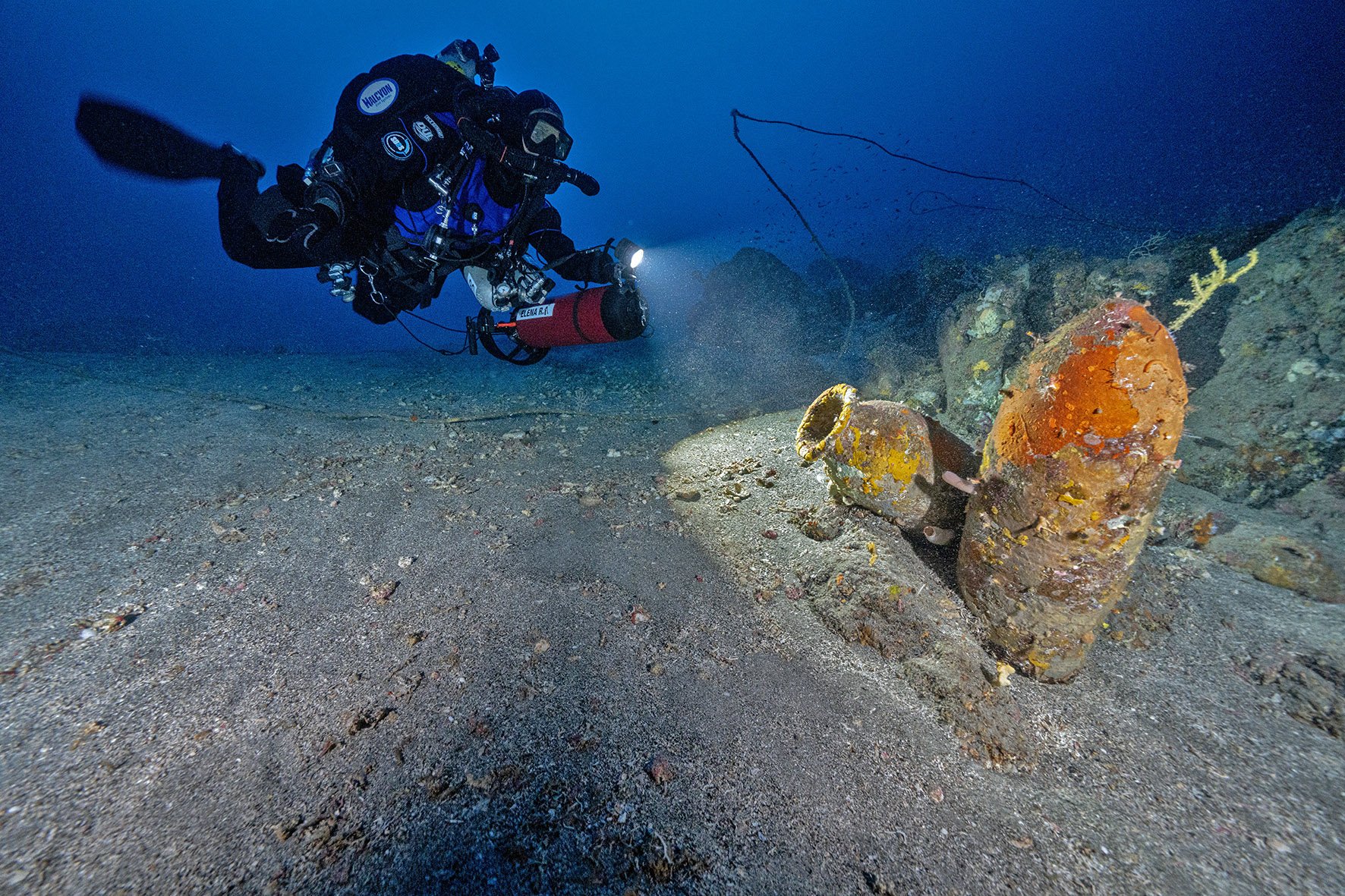
The western part of the Cape of Glaros is scattered with anchors mainly from the Middle Byzantine period. A closer study of the concentrations and the condition of some, combined with the concentration of pottery, probably date to the wreck of a large merchant ship of the 12th-13th c. A.D. Its cargo consisted of amphorae carrying wine. The multitude and dispersion of pottery gives the impression of a large cargo and therefore a ship.

Depending on the route, the diving visitor can observe the evolution of anchor types from different eras, the history of the last moments of a shipwreck through its anchors, as well as the combination of the marine environment and the remains of the shipwreck.

Glaros, Western Pagasitic, Byzantine amphora body,

©YPPOA-EEA, photo Matteo Collina Univerità della Calabria –DIMEG

The Byzantine shipwreck in Kikynthos Amaliapolis

Between the 11th and 12th centuries at the entrance of the Pagasitic Gulf, a Byzantine merchant ship was wrecked near the islet of Kikynthos, located to the east of the bay of Amaliapoli. The bulk of the wreck consists of pithos and amphorae. Its location was identified by the Institute of Marine Archaeological Research in 2005.

Today, the diving visitor can observe the remaining fragments of pithos and some amphorae, which constitute the main concentration of the wreck.

Kikynthos, Western Pagasitic, pitho fragments,

©YPPOA-EEA, photo Matteo Collina Univerità della Calabria –DIMEG

The Byzantine shipwreck at Akrotiri Telegrafos

At the bottom of the northeastern shore of Cape Telegrafos are the remains of a ship's cargo from the late Roman period. Its cargo consisted exclusively of trade amphorae. The excavation and study of the amphorae showed that they were carrying wine, garum (a fermented fish sauce which was used as a condiment), fruit and olives, with the main origin of mainland Greece and the Eastern Aegean.

View of Telegrafo’s shipwreck

©YPPOA-EEA, photo Stefanos Kontos

The ship's destination would be one of the ports of the Pagasitic Gulf, to exchange its cargo for grain. Most likely, a rough sea overturned the ship and its cargo was lost at the bottom until it was "recovered" by the research of the Institute of Marine Archaeological Research. The visiting diver can observe the site and the traces of the underwater excavation, where part of the scattered cargo is preserved.

Wreck cargo collection area 9 in Kikynthos. Sections of pithos and amphorae can be distinguished

©YPPOA-EEA, photo Stefanos Kontos

At the Public Information and Awareness Center for the three Visitable Underwater Archaeological Sites, the visitor can have the experience of virtual diving with 3D augmented reality glasses. Thanks to the virtual tour the underwater world of the three wrecks becomes universally accessible, even to those who cannot do natural diving.

View of Telegrafo’s shipwreck

©YPPOA-EEA, photo Stefanos Kontos

The three new underwater archaeological sites, together with the underwater archaeological site of Alonissos, make up a unique underwater archaeological park with a unique diving experience at an international level.